01 -02
13th Session of the UN-GGIM Committee of Experts


The Pan American Institute of Geography and History (PAIGH) had the honour of being invited as an observer to the 13th Session of the United Nations Committee of Experts on Global Geospatial Information Management (UN-GGIM). Mr. Antonio Campuzano Rosales attended in his capacity as Secretary General of this scientific and technical body.
The Committee’s main objective was to lead the coordination, maintenance and accessibility of geospatial information and resources worldwide.
In his speech, Antonio Campuzano Rosales highlighted the importance of the UN Integrated Geospatial Information Framework and congratulated the efforts of its High-Level Group. He also reaffirmed the PAIGH’s commitment to aligning its goals with the IGIF and supporting its global implementation.
Finally, he encouraged all Member States, Observers, and organisations to collaborate in its implementation and promotion to support the Sustainable Development Goals.
14
Meeting between the PAIGH and Esri for the development of geospatial projects


The purpose of the meeting was to continue the existing Cooperation Agreement between PAIGH and Esri. In addition, two key projects are planned for the future: a Story Map on the Integrated Map of the Americas and another on the Centenary of PAIGH, both using the ArcGIS Online platform.
15
Meeting for the continuation of the Atlas of Climate Change in the Americas (ACCA) Project

Researchers Oscar Luis Pyszczek (Colombia) and Patricia Snaider (Argentina) held a virtual working meeting with the Secretary General of the Pan American Institute of Geography and History (PAIGH). During the meeting, Mr. Campuzano expressed interest in continuing the Atlas of Climate Change in the Americas (ACCA) initiative, which was developed between 2017 and 2019 under the PAIGH Technical Assistance Programme, in collaboration with various universities and countries in the region.
15
Meeting with the Brazilian Ambassador to Mexico


Visit by His Excellency Fernando Coimbra, Brazilian Ambassador to Mexico, and Mr Patrick Luna, an official from the same Embassy, who were received by Mr Antonio Campuzano Rosales, Secretary General of this international organisation.
In keeping with the goal of strengthening ties of cooperation between this Member State and the PAIGH, as well as informing Ambassador Fernando Coimbra about the activities carried out by this organisation and presenting its history, mission, vision, and alliances with other international organisations, Mr. Campunano gave a comprehensive presentation to the guests.
This is how ties of friendship and cooperation are strengthened, with the intention of fulfilling the mission of this international organisation, always seeking new avenues for the dissemination of scientific knowledge within the Pan-American community.
16
Meeting on Geospatial Data Infrastructure in the Americas
The Secretary General of the PAIGH held a virtual meeting with Álvaro Monett, from the Economic Commission for Latin America and the Caribbean (ECLAC); Sofía Nilo, President of UN-GGIM: Americas; Pamela Castillo, Executive Secretary of the same entity; and, as a guest, Max Lobo, President of the Cartography Commission of this Institute.
The objective of this session is to continue the work of the Geospatial Data Infrastructure of the Americas (GDI Americas) portal. The purpose of the site is to provide access to a wide and varied collection of geospatial information resources in the region to support sound decision-making at various territorial levels in the region. The logic of IDE Americas is distributed and based on the connection of nodes at various territorial levels, from the global to the subnational.

Presentation of the award for ‘Best Doctoral Thesis in Pan-American History, 2022 edition’


Mr Antonio Campuzano Rosales, Secretary General of the PAIGH, was invited to participate, virtually, in the presentation of the award for ‘Best Doctoral Thesis in Pan American History, 2022 edition’. Accompanied by Geographer Marilyn Romero, President of the National Section of the PAIGH in Costa Rica, Dr. Filiberto Cruz, President of the PAIGH History Commission, recognised Dr. Sofía Vindas Solano as the winner of the award for her thesis “Making Central America Exportable: Activation of International Artistic Circuits and their Impact on the Consolidation of Modern Art Museums and their Collections in Guatemala and Costa Rica, 1950-1996.”
17


The Pan American Institute of Geography and History (PAIGH) and the Latin American Institute for Educational Communication (ILCE) have signed a strategic alliance to promote cooperation in education and research in Latin America and the Caribbean. The signing of a Framework Agreement for Collaboration reflects the commitment of both institutions to advance education and development in the region.
The agreement between the two institutions will strengthen education and research in the region by enabling the exchange of knowledge and resources. It goes even further, opening doors to future joint projects and activities that will promote sustainable development in the region.
18
Strategic Meeting of the PAIGH with the History Commission: Preparations for the Technical Meeting in Santo Domingo

Strategic meeting with the Chairman of the History Commission, Dr Filiberto Cruz, to coordinate the agenda for the Joint Technical Meeting of the Commissions, scheduled to take place on 30 and 31 October in Santo Domingo, Dominican Republic.Durante este encuentro, los expertos presentarán avances técnicos y promoverán la colaboración para aprobar proyectos conjuntos en el marco del Programa de Asistencia Técnica del IPGH.
22
Virtual meeting between the PAIGH and the Dominican Republic to coordinate upcoming events in Santo Domingo
Virtual meeting with Mr. Bolívar Troncoso, President of the National Section of the PAIGH in the Dominican Republic and Director of the National Geographic Institute “José Joaquín Hungría Morell,” together with his team of collaborators.
The objective was to continue coordinating joint actions for the realization of important events: the 24th General Assembly, the 100th Meeting of Authorities, the 5th Technical Meeting of the Commissions, and the Dominican Congress of Geographical Sciences, scheduled from October 30 to November 4 in Santo Domingo.

Current cooperation between PAIGH and Esri
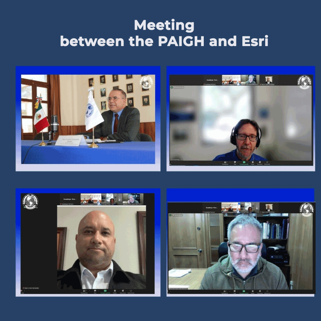
For the development of the “Story Map” project, based on the Integrated Map of the Americas. During the meeting, they discussed a possible new agreement between both entities to update new approaches and strengthen joint efforts.
The aim is to use ArcGIS Online to make it easier for researchers to contribute to the Integrated Map of the Americas and improve the dissemination of this project. In this way, both entities will benefit from a new agreement, while scientists will be able to consult and collaborate with their own material on the platform.
23
Organization of the 5th Technical Meeting of the PAIGH: Progress on the Work Agenda
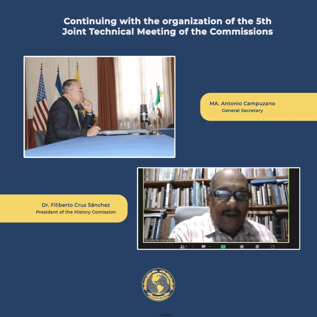
Continuing with the planning for the 5th Technical Meeting, Mr. Antonio Campuzano, Secretary General of the PAIGH, held a virtual meeting with Dr. Filiberto Cruz, President of the History Commission. The objective was to advance the organization of the working agenda for the event, which will take place on October 30 and 31 in Santo Domingo, Dominican Republic, as part of the Institute’s Statutory Meetings.
25
“Historical Framework During 200 Years of Training Leaders at the Heroic Military College,” held from August 22 to 25, at the headquarters in Tlalpan, Mexico City
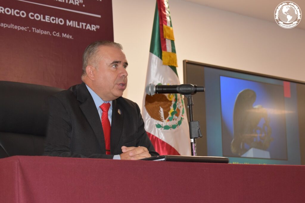
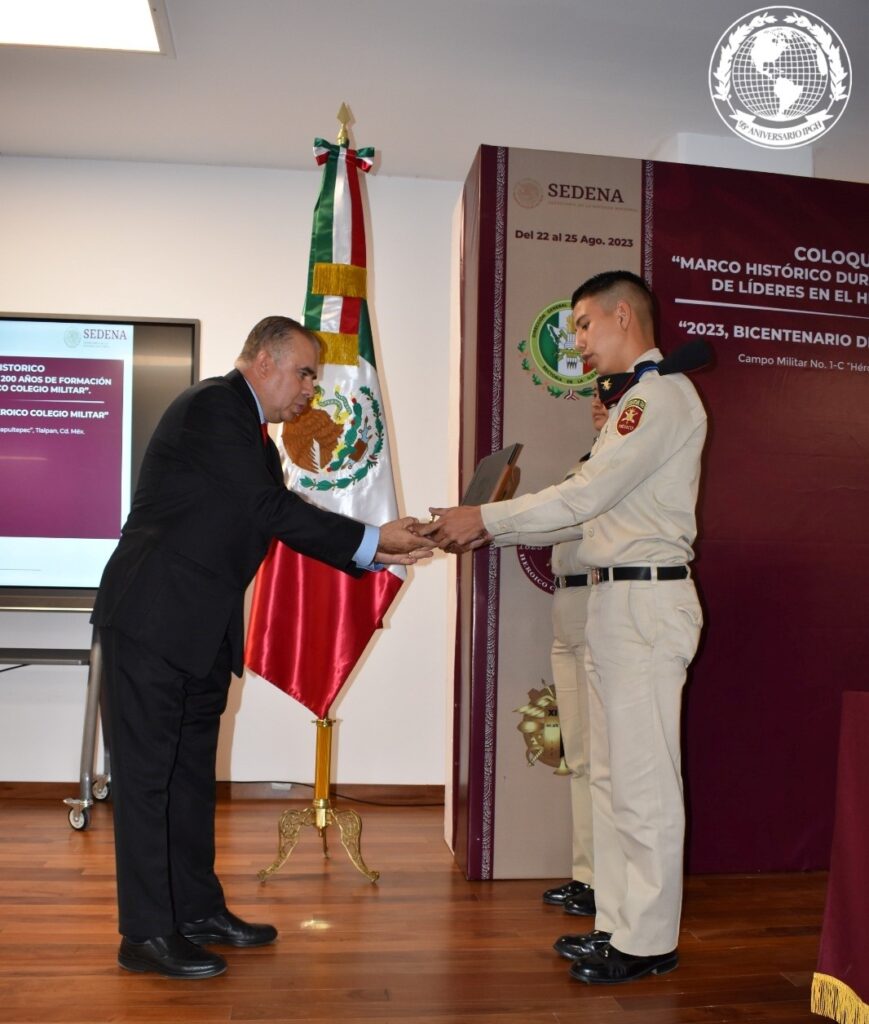
MA. Antonio Campuzano Rosales, Secretary General of the Pan American Institute of Geography and History (PAIGH), participated as a speaker in the Colloquium “Historical Framework During 200 Years of Leadership Training at the Heroic Military College,” held from August 22 to 25 at the headquarters in Tlalpan, Mexico City.
The PAIGH congratulates the Heroic Military College for its work in training officers who embody the military values and virtues that have guided generations of Mexicans over the last 200 years.
30
Coordination for the Publication of the American Congress of Freedom
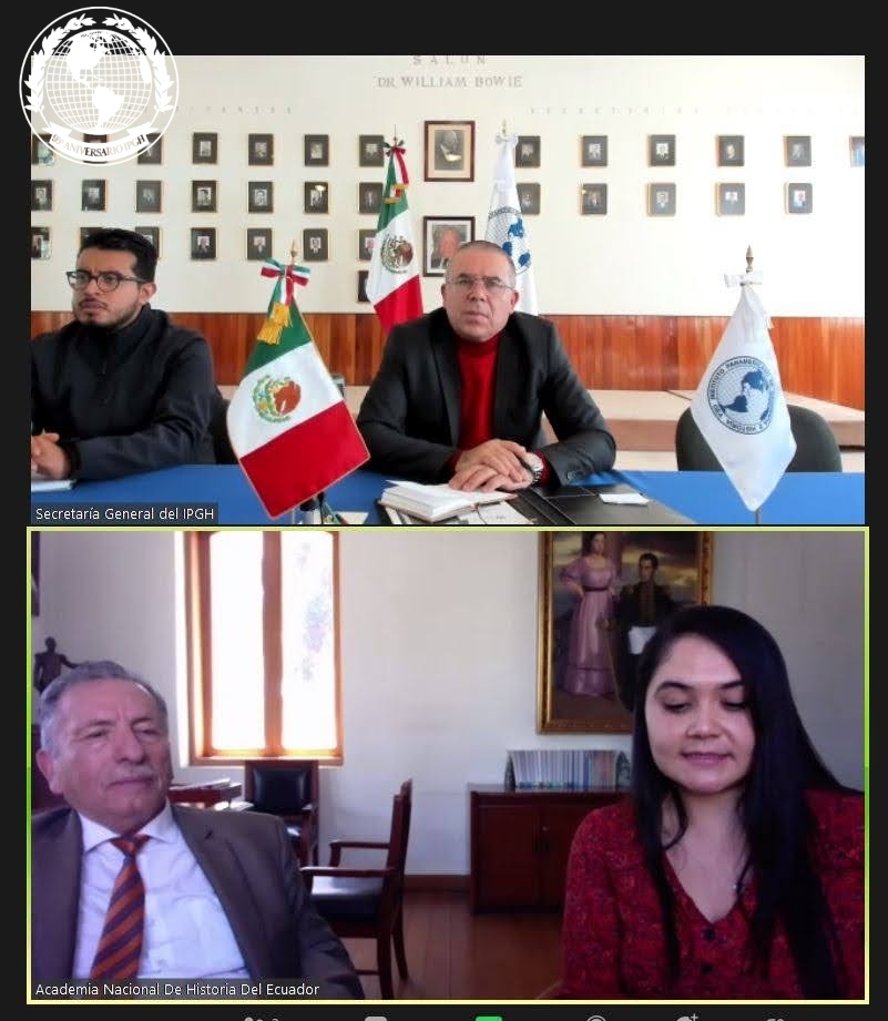
Following up on the Second Academic Conference of the American Congress of Freedom (May 2023), Antonio Campuzano, Secretary General of the PAIGH, held a virtual meeting with Dr. Franklin Barriga, Director of the National Academy of History of Ecuador. The objective was to coordinate the creation of a work compiling the presentations given at the Congress, recognizing the valuable work of the distinguished Latin American speakers who participated in the event.